
For Your Research
House History Resources from HPO
Time Slider – HistoryQuest DC
To get started, go to HistoryQuest DC When the GIS map appears select “DC by the Decades” on the banner at the top of the page. Once the mapping element appears, select the clock icon displayed at the top of the screen to activate the mapping tool .
Additional information is available by selecting the information icon “i”, also at the top of the screen .
HistoryQuest DC, is an interactive GIS map that provides historical data on approximately 127,000 extant buildings in Washington, DC. The map is the culmination of a two-decade project sponsored by the DC Office of Planning/Historic Preservation Office resulting in operational layers of information for the user including historic data on individual buildings, links to documentation on properties listed in the National Register of Historic Places, information on historic residential subdivisions, and the identification and boundaries of the L’Enfant Plan, and the city’s Squares, and Wards.
Posted by: Bruce Yarnall, bruce.yarnall@dc.gov
Finding Historic Photographs of Capitol Hill Houses
Photographs of Capitol Hill houses from the past may be available from several sources. This article focuses on photographs of existing buildings.
PHOTOGRAPH COLLECTIONS
It’s a big universe. You may want to start by searching these collections online, and then visit the libraries and consult librarians for additional help. The box shows contact information for Library of Congress (LOC), Washingtoniana, and Historical Society of Washington, DC (HSW).
ONLINE SEARCHES:
Library of Congress (LOC)
“Researching Historic Washington, D.C. Buildings,” www.loc.gov/rr/print/coll/dcbuildings.html
- Historic American Buildings Survey (HABS): Photographs and information on buildings. Direct link to image gallery
- Carol M. Highsmith Archives. www.loc.gov/collections/carol-m-highsmith/about-this-collection/
- Other LOC photograph collections: Civil War; Farm Service Administration; Harris & Ewing; Theodor Horydczak; Stereograph Cards, Miscellaneous Items in High Demand.
Historical Society of Washington, D.C. (HSW)
dchistory.org. Wymer Photograph Collection of HSW: In 1949 and 1950 John Wymer systematically photographed every neighborhood in Washington. Note: HSW has multiple additional photograph collections.
DC Public Library (DCPL)
- The Washington Post (1877-present) and The Washington Evening Star (1851-1981) are searchable on the library’s website. Real estate advertisements, in addition to articles, may have photographs.Visit www.dclibrary.org. From the top menu, choose Research >Databases> Newspapers Local>The Washington Post, or The Washington Evening Star. Or go directly to the Local Newspapers page to choose the Post or Star. Then login with your DC Library card number and start searching. For example, type in an address with quotes around it, e.g.: “1333 E Street.” On October 9, 1926 The Washington Star ran an advertisement and photograph of this house in NE.
- The Willard R. Ross postcard collection is comprised of original photographic postcard prints, primarily of the streets and architecture of Washington D.C. and the surrounding areas from the 1910s to 1930s.
Department of Transportation’s (DDOT) “Back in Time”
DDOT has an archive including 9,000 photographs of streets and buildings; many are digitized and available online at ddotlibrary.omeka.net. Browsing the collection is a good place to start. Kathleen Crabb, kathleen.crabb@dc.gov
CHRS
www.chrs.org has some house histories (chrs.org/history-and-preservation/house-histories/), and the annual CHRS House and Garden Tour brochures (chrs.org/house-and-garden-tour/tour-brochures/) with information about houses on that year’s tour. Some photographs (taken after 2000) of houses outside the Capitol Hill Historic District are available in the Beyond the Boundaries documentation (chrs.org/history-and-preservation/beyond-the-boundaries-map/).
Other Sources
www.capitolhillhistory.org. For example, Lorraine Reid’s 1947 photographs.
See also www.shorpy.com and www.ghostsofdc.org.
RESEARCH TIPS:
See each library’s website for search tips.
- If your house is near a well-known building, a photograph of that building may also show your house. Examples include the Capitol, churches, schools, fire stations, commercial buildings, the Navy Yard, streetcar barns, hospitals and large parks.
- Search by street name, in addition to searching by address. Street names have changed. B Street NE and SE became Constitution Avenue, NE and Independence Avenue, SE. Georgia Avenue, SE became Potomac Avenue, SE. Address numbers may also have changed.
- Search by the name of an individual, company, or organization associated with the house.
VISITS TO LIBRARIES:
There may be additional photographs which the librarians can help you find. Contact information is below. For LOC you may need to get a free researcher’s ID. For each library, it’s a good idea to find out in advance how to pay for copies of photographs and what formats are available. Bringing a flash drive is a good idea. You may need a quarter to rent a locker.
Washingtonian at the MLK Library has a large collection, including indexes and past issues of the Washington Star on microfilm and also has vertical files on many topics.
Books and periodicals:
- Records of the Columbia Historical Society. HSW
- Robert Reed, Old Washington, D.C. In Early Photographs 1846-1932 (New York, N.Y.: Dover Publications, Inc, 1980)
Physical archives:
Library of Congress (LOC) Prints and Photographs Collection (Madison Building)
Independence Avenue SE between 1st and 2nd Streets
The entire LOC collection is at the Madison Building; a subset has been digitized and is available online at:
www.loc.gov > Prints and Photographs
Martin Luther King, Jr. Memorial Library Washingtoniana Division – undergoing renovation, 2017-2018
901 G Street, NW (3rd floor)
dclibrary.org/mlk/interim [was mlkjrlibrary@dc.gov]
make an appointment: dclibrary.org/research/appointments
202 727-1213
Historical Society of Washington, DC (HSW)Kiplinger Research Library – undergoing renovation, 2017-2018
801 K Street, NW
dchistory.org
202 249-3955
Historic Alley Building Survey – HPO
The DC Historic Preservation Office has prepared a study of alley buildings: stables, carriage houses, garages, and workshops. The DC Historic Alley Buildings Survery (2014)
Mapping Early Washington – 1822 City Directory – Community Forum
Brian Kraft presented “Mapping Early Washington”, on June 28, 2018.
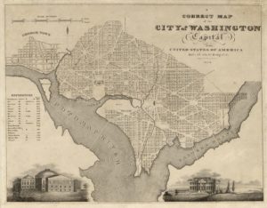 For nearly two decades, DC history specialist Brian Kraft has combined his background in data management with his abiding interest in local history to create innovative tools for social science researchers, historians, and anyone interested in the history of their own home or neighborhood. He introduced the audience at the June 28 CHRS Community Forum to several of his projects, beginning with the current one, Mapping Early Washington.
The project uses GIS technology to show how Washington City developed from the initial division into squares and lots. He added data on individual homeowners using the 1822 and 1858 City Directories, which yielded a map showing of clusters of selected occupations, from laborers to surgeons. Mr. Kraft intends to expand the project to include tax assessment, census, and other data to produce a rich, fact-based history of our city.
You can see the maps created by this project, and learn about Brian Kraft’s other projects, on his website: briandkraft.blog. Visit planning.dc.gov/node/1203082 to learn more about HistoryQuestDC, an application funded by the District’s Historic Preservation Office (HPO), or find Kraft’s most most recently completed project, the Atlas of Early Capitol Hill at Atlas of Early Capitol Hill.
The presentation was preceded by a brief membership meeting to announce the result of elections for the CHRS Board of Directors.