Mapping Early Washington – 1822 City Directory – Community Forum
Posted on June 20th, 2018
Brian Kraft presented “Mapping Early Washington”, on June 28, 2018.
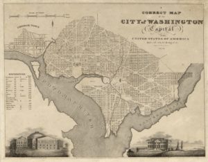
For nearly two decades, DC history specialist Brian Kraft has combined his background in data management with his abiding interest in local history to create innovative tools for social science researchers, historians, and anyone interested in the history of their own home or neighborhood. He introduced the audience at the June 28 CHRS Community Forum to several of his projects, beginning with the current one, Mapping Early Washington.
The project uses GIS technology to show how Washington City developed from the initial division into squares and lots. He added data on individual homeowners using the 1822 and 1858 City Directories, which yielded a map showing of clusters of selected occupations, from laborers to surgeons. Mr. Kraft intends to expand the project to include tax assessment, census, and other data to produce a rich, fact-based history of our city.
You can see the maps created by this project, and learn about Brian Kraft’s other projects, on his website: briandkraft.blog. Visit planning.dc.gov/node/1203082 to learn more about HistoryQuestDC, an application funded by the District’s Historic Preservation Office (HPO), or find Kraft’s most most recently completed project, the Atlas of Early Capitol Hill at Atlas of Early Capitol Hill.
The presentation was preceded by a brief membership meeting to announce the result of elections for the CHRS Board of Directors.


