Beyond the Boundaries
Find detailed historical information about buildings just outside the Capitol Hill Historic District.
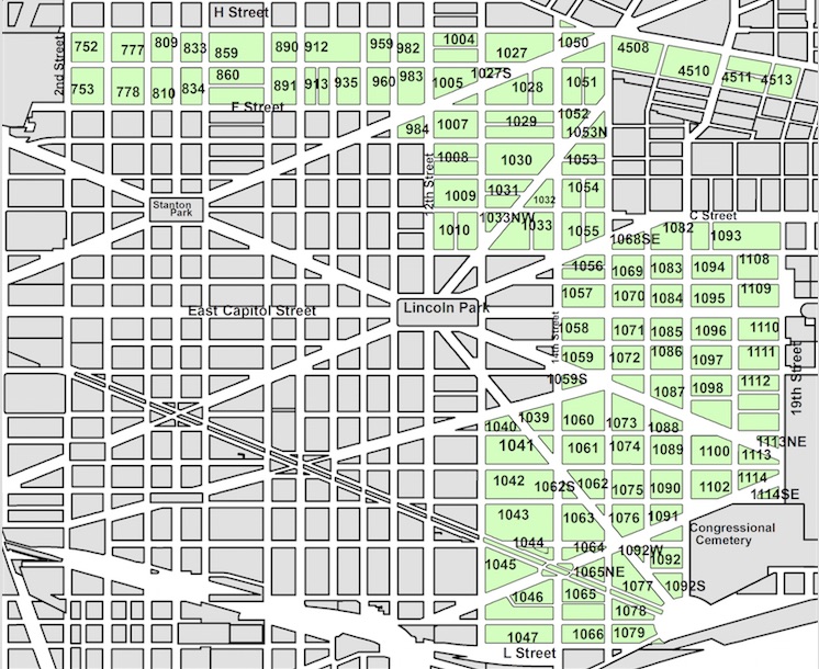
Beyond the Boundaries is a CHRS survey that provides historical information about individual houses just outside the Capitol Hill Historic District. Our survey resulted in a .pdf document for each square, or city block, that includes detailed information about every building on that block. The squares use the same numbering system as the DC Office of Tax and Revenue.
How to search:
-
Locate the block, or square, on the map that interests you, and note the number
-
Find the number in the list below the map and click on it
-
Search for the house or building in the .pdf document
